🚚
Oil, Gas & Mining Supplies
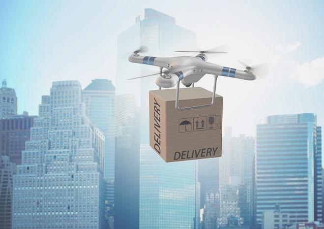
Delivering critical parts, sensors and supplies to remote or hazardous sites while minimizing downtime.
Shree Mewar Robotics & Resarch Services LLP is been affiliated to Shree Mewar Aviation LLP which is into Aviation business from last 7 Years by providing various aviation services in India and around the world. We are into the drone market to make things simpler and advanced in the sector of UAM/ DRONES/RPAS/UAV by making them available for Agriculture, Mapping, Freight and Supply Chain Logistics, Emergency Response, Aerial Inspection and many other possible sectors where drone or UAM or UAV can make a big difference. We are presently only single parent company to operate in this sector in Rajasthan. The company is been approved by DGCA of India.
SMRR (Shree Mewar Robotics & Research Services) offers drone services that provide a new dimension to logistics, aerial photography, aerial surveillance reconnaissance, inspections among other industries. Our extensive solutions are of high quality enabling us to provide premium services for our clients. Be it in delivering relief aid, fighting poaching to inspections of critical infrastructure, our drones provide a multitude of solutions people face every day
Our cargo drone has a payload capability of up to 1500kg, 1000 Km Range and flight time of up to 24 hours on surveillance mode.
Our smaller drone is capable of 8 hours of flight carrying up to 4 Kg payload. These drones are suitable for Humanitarian cargo air transport, medical deliveries, Aerial mapping and imagery, Aerial Surveillance and Security, Agriculture, Oil and gas services, connectivity, emergency response among others.
AGRICULTURE
AERIAL MAPPING
FRIEGHT & SUPPLY CHAIN LOGISTICS
AERIAL INSPECTIONS
EMERGANCY RESPONSE
CONSERVATION
DRONE SHOW
UAV CUNSALTANCY
TRAINING (RPL SCHOOL)
Goldman Sachs predicts that the agriculture sector will be the second largest user of drones in the world in the next five years. Sensor networks based on the Internet of things (IoT) are increasingly being used in the agriculture sector to meet the challenge of harvesting meaningful and actionable information from the big data generated by these systems.
Using Infra Red, Thermal sensors and multispectral sensors allows direct visibility over the health of your field. Our solution gets you data on sunlight absorption rates, transpiration rates, crop health, soil quality and more
Over the past several years Unmanned Aerial Vehicles (UAVs or drones) have rapidly advanced through improved flying ease, and high quality still and video photography. They have become prominent consumer products, and offer potential for low elevation aerial photography to support research and commercial applications.
Most such applications feature visible light photography, but we anticipate that future remote sensing applications will include thermal and near-infrared imagery and beyond.
Download Robotics Brochure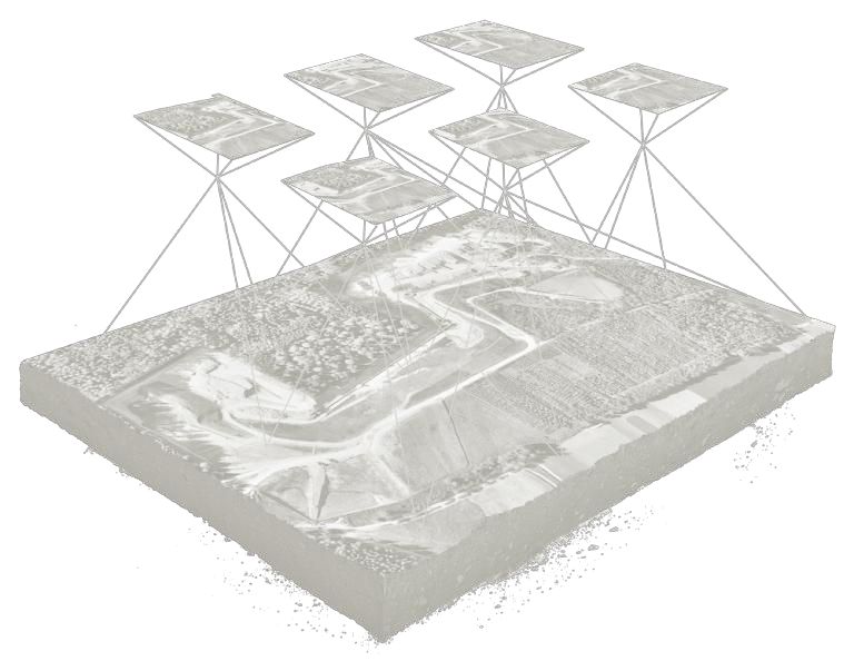
Most people think of a drone (UAS) as military equipment or a hobby tool for images and video. Today, businesses across industries are deploying drones for transformational commercial applications that go far beyond surveillance and photography.
Delivering critical parts, sensors and supplies to remote or hazardous sites while minimizing downtime.
Rapid drone-based delivery of medical kits and life-saving equipment in emergency scenarios.
Supporting last-mile logistics with faster, safer, and contactless deliveries.
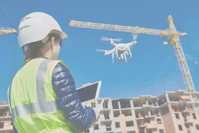
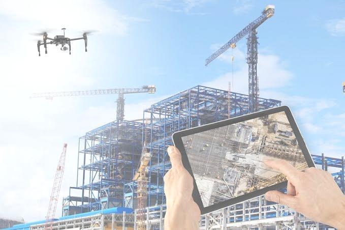
The rapid advances in sensing, battery, and aeronautics technologies, together with autonomous navigation and low-cost digital cameras, have made UAVs more affordable, reliable, and easy to operate. Today, Architecture/Engineering/Construction and Facility Management (AEC/FM) firms and other service companies use drones to visually monitor construction and civil infrastructure projects such as buildings, bridges, and more.
Monitoring the condition of buildings, bridges, towers, and other structures with accurate aerial insights.
Detecting track misalignments, monitoring rails, and ensuring safe, cost-effective railway operations.
Aerial assessment of dam walls, spillways, and water channels to support maintenance and safety checks.
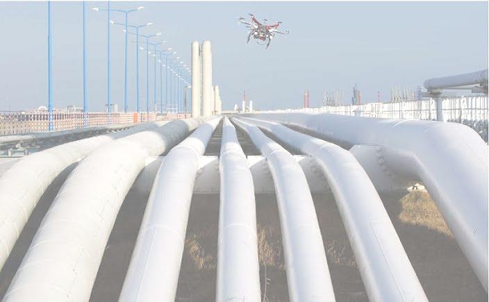
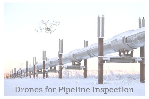
Identifying leaks, cracks, and corrosion in pipelines across long distances without human risk.
The potential of drones to assist in maintaining power & utilities networks is even greater. Maintenance of assets spread across a vast area, accessing hard-to-reach infrastructure and execution of dangerous inspection procedures normally performed by humans, or by expensive helicopters or airplanes, can all be replaced by drones. UAVs make inspections cheaper, faster, and safer.
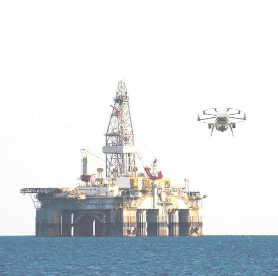
The oil and gas industry is increasingly relying on drones for inspection. These UAVs can reach hazardous spots, measure with precision, and save significant time. Tasks like inspecting flares, cooling towers, or under-deck areas that usually require ropes and pose safety risks are now simplified with drones, which need little setup time and provide accurate results.
Unmanned aerial vehicles (UAVs) have recently gained popularity in the geosciences because they can systematically capture high-resolution aerial photographs at relatively low cost across large surface areas. Using computer vision, overlapping photos create 3D photorealistic models that deliver accurate digital elevation data, speeding up geological workflows significantly.
Humanitarian drone use emerged initially from the drone industry’s interest in acquiring legitimacy and moral capital, but the focus has since shifted to how drones can assist in humanitarian action. The applications have broadened from monitoring to a wide range of disaster management tasks.
When a disaster occurs, Shree Mewar Robotics drones may be used to provide first responders with situational awareness, locate survivors, analyze infrastructure, deliver supplies and even help extinguish fires.
Ecology has only flourished as an area of research in the last 50 years, once the impact of global change became evident on both the lives of animals and those of humans as well. Researchers have since developed methods in ecology to monitor and help understand the impact of ongoing global change, improve the Earth’s biodiversity system, and predict the future trends of ecology and its development.
In order to achieve these goals, the Earth must be monitored through a complete, accurate and rapid collection of data, which can now be done very efficiently with the help of drones.
We tell stories and create legends. We extend the borders of possibilities and discover a new world to explore. We offer an opportunity to create your own story.
Main feature in Drone Show is it can include a maximum 2000+ drones at a time, 10 min max show duration, and 3 km visibility range.
Between 2018 and 2020, a $100 billion market opportunity for drones had been forecasted
towards the end of 2018. These were findings published by Goldman Sachs.
Shree Mewar Robotics & Research Services, an Indian drone operator, understands the Indian
drone market and is able to give you invaluable insights on the same. With vast knowledge of
Sub-Asian and global drone trends, our team of young experts, backed by Shree Mewar Aviation’s
7+ years of aviation expertise, ensures accurate consultancy services.
RPTO training school is a premier training institution that offers robust training courses customized for individuals at all levels—from beginners to professionals with aviation experience. Strategically located in Udaipur, Rajasthan, we combine ground school theory, simulated scenario-based training, and practical flying to make you industry-ready.
Training on the use of drones for commercial purposes. On successful completion, students obtain a commercial RPTO Pilot license. Options include:
Advanced courses designed to solve local problems with drone technology. Industries include:

Managing Director
Leading the MHS Group with 13+ years of experience in Indian Aviation. Provides vision, leadership, and expertise in aviation operations.

CEO / Director
An M.Com in Business Administration, she looks after all marketing and administrative processes, driving business growth and efficiency.
We also have a dedicated full-time staff of 15 members, ranging from Operations to Accounts, Marketing & PR – all working together to ensure excellence.
Stay connected with us on social media:
Visit our websites: